History of Audubon Park
|
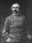
The area that now comprises the City of Audubon Park was once part of 1000 acres of rolling farm and pastureland granted to Colonel William Preston in 1773 by King George III as payment for services rendered during the French and Indian War. At that time, what is now Kentucky was part of the Commonwealth of Virginia. The Preston family was prominent in military and civic matters in Kentucky and Virginia. Col. Preston was the chief surveyor of Fincastle County, which at that time included all of Kentucky. One of his grandsons, also named William Preston, was a Confederate general and later practiced law in Louisville. He was also elected to the Kentucky House of Representatives, was elected to Congress in 1852, and served as Minister to Spain in 1859. The original William Preston’s heirs continued to use the land granted by King George III as farmland until the late 1800's. In 1906, 722 acres of this land was sold to G. Robert Hunt, who was a prominent broker in Louisville and partner in Hunt, Bridgeford and Company. An additional 150 acres was leased to Russell Houston for development of the Audubon Park Country Club & Golf Course. Audubon Park Community Club opened on July 4th, 1909.
In 1911, after the success of the golf course development, J. R. Bridgeford and Richard Ten Broeck sold more than half their interest led to the Audubon Park Realty Company which was a holding company for Prestonia Realty Company. Audubon Park Realty Company consisted of James L. Smyser, Jr., David A. Keller, Jacob L. Smyser, Harry L. Smyser, and G. Robert Hunt who retained a 1/3 interest and brokered the deal also wanting to participate in the development of Audubon Park. They, in turn, hired Clifford B. Harmon & Co. of New York City; this firm was recognized as successful developers of suburban properties. The property was marketed as combining the best attributes of city and country life, including an emphasis on its higher elevation – a selling point to residents of flood-prone Louisville. Clifford B. Harmon & Co. hired local William Speed to develop 230 acres of Audubon Park.The development of Audubon Park was considered a move toward “democratic architecture” which espoused socially conscious development revolving around promoting health and welfare through careful planning of green spaces and other elements of a more natural environment. It also promoted homes with more simple, less pretentious plans unlike Victorian-era housing.
Also supporting the successful development of construction in the area was the Interurban, which was Louisville’s commuter rail system. An Okolona route was established in 1905 which ran from Fourth and Jefferson in Louisville and ran the length of Jefferson County along what is now Preston Highway. After the start of development in Audubon Park, a stop was added to the line at the intersection of Chickadee and Dove Roads which allowed residents to travel to Louisville in approximately twenty minutes. This close proximity to the city of Louisville helped spur suburban growth. The popularity of the automobile in the 1920's ultimately led to the ending of the Interurban in 1933. The area’s Interurban station subsequently became a single family dwelling located at 3218 Chickadee Road. The last of the track for the Interurban was removed when sewers were installed in 1975.
|
|
The city was designed along a grid plan of tree-lined streets, with planned green spaces. In 1911, there were two houses in the area and by 1916, 65 homes had been built. A brief pause in construction momentum occurred after 1914 due to the interruption of WWI, but resumed during 1917-23 after the advertised expansion of natural gas lines to the suburb. Thrush Road was the most heavily developed road in the early years of Audubon Park by 1917. In the same year, the federal government purchased 420 acres for Camp Zachary Taylor, leaving Audubon Park with approximately 230 acres. Some Audubon Park residents rented rooms to the wives of soldiers stationed at Camp Taylor. Camp Taylor was focused on preparing Army Chaplains for military assignments as well as field artillery officers. A canteen for Camp Taylor was located at the present location of Audubon Traditional Elementary School on Hess Lane.
In the beginning of Audubon Park’s development, five acres were planned as a nursery to start ten thousand young trees which could be permanently planted along the development’s streets to enhance the landscaping in the former pastureland. There were five parks developed as part of the landscape plan: Wren (now known as Henderson), Robin, Oriole, Crossbill (now known as Triangle), and Curlew.
Interestingly, in the original development, building and landscaping restrictions were included with every lot sale. This was done to ensure a uniform appearance in setback of the homes and in green spaces. No fences were allowed to obstruct the view of green spaces in the front yards. Owners were required to purchase a minimum of two lots, usually being 25 feet wide and 200 feet deep. Houses had to be set back from the road a minimum of 30-50 feet with no alleys. There was to be at least a 10 foot easement on each side of the lot from the dwelling. All outhouses “must be under one roof”. In the initial deed restrictions, homes were not to cost less than $3500 and properties could not be subdivided for 20 years to create additional residences. In addition, no houses intended for business purposes could be erected in the first 15 years without the consent of the Audubon Park Realty Co. These design restrictions were placed on the deeds and subdivision plats to ensure orderly development of the neighborhood with all plans approved by the Audubon Park Realty Co.
During the 1920’s which was characterized by a booming economy and the growth of automobile use, construction in Audubon Park likewise boomed as the city was promoted as having amenities such as natural gas, city water and electricity while also providing fresh air and ample green space. The latter attributes were important as Louisville had a high rate of tuberculosis. Common early housing styles found in Audubon Park included bungalow and Craftsman style homes, followed in the 1920-30’s by Tudor Revival and Colonial Revival. After WWII, Cape Cod and Colonial homes were popular styles for new housing. In the late 1920’s, after LG&E laid mains and streetlights, the rate of new home construction was an average of one house every two weeks.
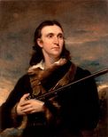
The Audubon Park Garden Club was established in 1929. This group had a major role in the conservation of the city’s parks and green spaces and in promoting tree planting. Among their goals was the promotion of a natural environment for birds, in homage to the naming of the city after naturalist and bird artist John James Audubon. In honor of Audubon, all but two of the city’s twenty streets are given the name of birds: Cardinal, Dove, Robin, Wren (re-named Henderson in 1996), Linnet, Thrush, Oriole, Chickadee, Crossbill, Falcon, Curlew, Teal, Widgeon, Meadowlark, Sora and Eagle Pass. The two exceptions are Audubon Parkway and Valley Drive. In 1978, through the efforts of city officials and members of the Garden Club, the City of Audubon Park was named a bird sanctuary.
The City of Audubon Park was established in 1941 as a 6th class city on April 17, 1941 by the State Assembly; it was later elevated to fifth class status in 1977. In 1941, Audubon Park had 400 houses and this number increased to 550 by the end of the decade. Construction of Standiford Field in the late 1940's also led to urbanization and construction in the surrounding area – bolstering growth in Audubon Park. The Audubon Park Realty Co. was dissolved in 1947 when all of its lots had been sold, signaling the fact the suburb was essentially fully developed. Construction of homes, however, continued and only a few lots to this day remain undeveloped.
The entrances to Audubon Park were marked with massive stone gateways. Originally there were three such entrances: off Preston Highway at Audubon Parkway, Oriole at Hess Lane, and at Poplar Level Road which was later demolished during the widening of this street in the 1960's. These gateways were considered “signature entrances” to emphasize the enclave that was Audubon Park.
In 1954 Audubon Park was added to the Registry of Historic Places and in 1996, Audubon Park was added to the National Register of Historic Places. Characteristics required for the nomination and ultimate award of this honor as a railroad or rail-related property included:
In 1977 Clarence Henderson was elected as the first mayor of Audubon Park. In October 1987, City Hall located at 3340 Robin Road was dedicated. In 2005, Audubon Park earned its first year of many Tree City USA designations. On November 8, 2022, Madeline Bozeman was elected as Audubon Park's first woman mayor.
- Located within walking distance to a rail line;
- Expedient travel to the city;
- Planned development
- Common green spaces;
- Availability of utilities such as natural gas, water services and electricity;
- Permanent residences;
- Buildings exhibiting architect or builder designs;
- Middle to upper class residents; and
- Important connections to automobile use.
In 1977 Clarence Henderson was elected as the first mayor of Audubon Park. In October 1987, City Hall located at 3340 Robin Road was dedicated. In 2005, Audubon Park earned its first year of many Tree City USA designations. On November 8, 2022, Madeline Bozeman was elected as Audubon Park's first woman mayor.
Portions of the Information above reprinted from:
Neary, Donna M., Kelly Hanna, and Monica Henderson. National Register nomination, Audubon Park Historic District, Louisville, KY, on file, National Park Service, Washington, D.C., 1996.
Neary, Donna M., Kelly Hanna, and Monica Henderson. National Register nomination, Audubon Park Historic District, Louisville, KY, on file, National Park Service, Washington, D.C., 1996.


